
The control of any drone always lies with the pilot who, for lower cost drones, uses visual tracking to determine its position and orientation. Beginner drones usually do not have GPS, but more advanced drones make use of GPS receivers within the navigation and control loop which allows for some smart GPS drone navigation features that include:
Position Hold: Allows the drone to maintain position at a fixed altitude and location.
Return to Home: The drone remembers the spot from where it took off from, and at the press of the return to home button, it will automatically return to this spot.
Autonomous Flight: The flight path of the drone can be predetermined by establishing GPS waypoints that define the trajectory. Then upon execution, the drone will use autopilot to follow this path.
All of these features require the use of a GPS drone system, so it is important for a drone pilot to have a basic understanding of how GPS works.
What is GPS Drone Navigation?
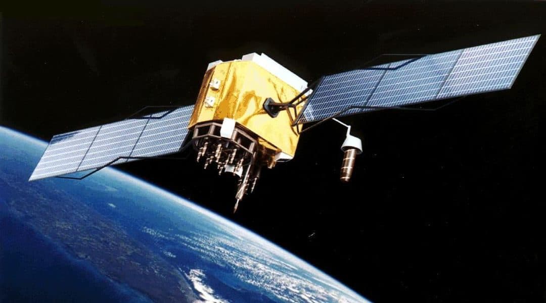
The global positioning system is a satellite navigation system that uses a radio receiver to collect signals from orbiting satellites to determine position, speed, and time. This navigation system is more accurate than over forms of navigation, and provides position knowledge to within a few meters. Advanced GPS systems can provide even better accuracies to within a few centimeters. The miniaturization of integrated circuits has allows GPS receivers to be highly economical, and available to everyone. GPS is a broadcast radio system that reaches almost all areas of the planet, so it is highly accessible.
The GPS system was developed by the US military in 1973 in order to develop an accurate navigation system for ICBMs. Knowledge of the target is well known, but for the US, knowledge of the launch coordinates was tricky since most of the US nuclear missiles were carried on submarines at sea. To successfully hit the intended target, accurate knowledge of the location where the submarine surface location was needed. Hence, GPS was developed to address this problem.
GPS Position Triangulation
GPS navigation is related to the concept of triangulation to determine a position on the ground. Triangulation a process where the location of a radio receiver can be determined by measuring the radial distance of the received signal from different sources.
For satellite navigation, we use trilateration which requires four signals to determine the position of a GPS drone receiver. The signal from one satellite allows you to determine that you are on a sphere at a given radius from the satellite. A second signal from another satellite is another sphere, which intersects with the first. So now you somewhere on a circle that intersects both spheres. A third signal narrows the location down to two points on the circle.
To determine the proper location from these two points, a fourth signal could be used, but usually one of the two points can be rejected due to being too far from the Earth, or moving at an improbable velocity. However, a fourth measurement is usually used, but for another reason.
Distance from Time
When you have a GPS receiver, the exact distance to the three or four satellite it receives a signal from needs to be determined. Each satellite transmits a coded signal that contain time stamped information regarding its position and time. The radio wave signals are travelling at the speed of light. If the receiver has an accurate clock, it seems like it should be a simple case of distance = time x speed. However, there is a problem with this approach.
The first problem is the need for synchronized clocks. Each GPS satellite has four atomic clocks, two cesium and two rubidium, providing time accuracy of one second in 100,000 years. The receivers have much less accurate clocks and have to compensate for the time taken to receive the signal.
Radio waves only travel at the speed of light in a perfect vacuum. The Earth’s atmosphere distorts and delays satellite signals. This effect must also be compensated by the receiver.
GPS Error Correction
If the receiver’s clock was perfectly synchronized with the satellite, then all of the ranges would intersect at a single point. What the receiver does is look for a single correction factor that it can apply to all the timing measurements that result in an intersection at one point. This correction factor can also be used to synchronize the receiver clock with the satellite clocks.
However, knowing the distances to the satellites is only part of the solution. We also need to have precise knowledge of the positions of the satellites. The orbits of the satellites are precisely modelled and it is possible to predict the future locations of each satellite. However minor perturbations cause a variation to the known orbit, but this is compensated for by ground based measurements of the satellite orbits. This information is available to the satellites, which is transmitted along with timing signals.
The effect of the atmosphere on the signal propagation can be mathematically modelled and predicted. These models take into account the effect of charged particles in the ionosphere, and the effects of the troposphere. The receiver accounts for the angle of each signal, since this determines the path length through the atmosphere.
Military vs Civilian GPS
AS previously mentioned, GPS originated as a US military innovation that gave US military forces an advantage over opposing forces. It was recognized that GPS would be advantageous for civilian use, but if civilians can pick up the same signal, that would negate the military advantage that GPS provided. The solution was to make two variants of the GPS. The Precise Positioning Service (PPS) was military grade, and the civilian version was the Standard Positioning Service (SPS). SPS receivers were made less accurate using the Selective Availability (SA) adjustment. However, SA was deactivated in 2000, improving the GPS accuracy for civilian use. Since this time, the use of GPS has significantly increased.
GPS Applications
Most people are accustomed to seeing GPS receivers being used for car driving navigation. But once you can determine your exact location on Earth, it opens the doors for further technological innovations. It is not hard to imagine self-driving cars that use GPS for navigation. Highway driving can also be made safer, if your car has precise knowledge of the position of the cars around it, thereby removing the need for error prone human drivers. The same logic can also be applied to air traffic control. Over the next decades, GPS will reduce the need for radar aircraft tracking systems.
Emergency first responders can benefit from GPS navigation, which can provide the shortest and fast route to the scene. Farmers are now using GPS systems in farm equipment to manage and harvest crops more efficiently. Farm animals, pets and wildlife can be more easily tracked using GPS collars. Visually impaired people, who have traditionally relied on seeing dogs, greatly benefit from having talking GPS modules.
Alternate GPS Systems
The US GPS satellites is but only one of several global satellite navigation systems. In 1982, the Soviet Union launched the GLONASS GPS satellites, which Russia continues to operate. Europe is developing the Galileo GPS system, while China is developing its own Compass GPS satellites. There are a few smaller GPS constellations including China’s BeiDou, and India’s IRNSS.
Typically, a GPS receiver only receives signals from one of these satellite systems. But there is no reason why one can’t use signals from multiple sources. The distribution of the US GPS satellites is such that at least four satellites are visible from any location. Combining signals from GPS, GLONASS, and Galileo can greatly increase the positional accuracy determination, and eliminate the problem of tall buildings blocking signals. The more satellites that are in view of the receiver, the greater the positional accuracy. There are several drone modes XXXXXX that utilize both the US and Russian GPS satellites, thereby increasing navigation robustness. The ability to utilize multiple GPS sources is a highly advantageous, and is a feature you should look for when buying a more advanced drone.
GPS Issues and Challenges
As good as the GPS systems is, there are several problems inherent in the current system. The GPS satellites have a finite lifetime, and need to be periodically replaced. Space is a hazardous environment leading to satellites being damaged or destroyed by meteors, or solar flares. The biggest concern with GPS is related to privacy and tracking. It is possible to place a GPS tracking device on an individual or a vehicle.
GPS Drone Navigatino Waypoints
The incorporation of GPS receivers in advanced drones allows for GPS drone waypoint navigation. This is an advanced technology that allows a drone to autonomously fly to preprogrammed points. This system can instruct the drone how fast, how high, and where to fly. It can also be programmed to hover for a period of time over each waypoint.
Drones are increasingly being used for surveying building construction, road maintenance, and infrastructure inspections. Agricultural applications include crop inspection, and tracking farm animals. Using GPS drone waypoint navigation, an area can be inspected at the predesignated positions. The drone controller is then able to focus his attention on the camera, and conduct the inspection.
The advancement of GPS drone navigation has greatly increased their utility and range of applications.